A Clearinghouse for Street Planning and Location-Based Intelligence
LocationlQ combines AI assistance, street-level data, and user-friendly insights to help utilities, municipalities, and other stakeholders coordinate projects and events more effectively—without requiring technical or GIS expertise.
LocationIQ serves as a central clearinghouse for street planning and location-based intelligence—streamlining collaboration across all key stakeholders involved in public infrastructure and urban development.
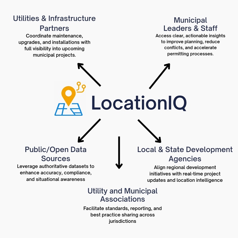
At the heart of LocationIQ is a unified intelligence layer that brings together insights from:
Utilities & Infrastructure Partners – Coordinate maintenance, upgrades, and installations with full visibility into upcoming municipal projects.
Municipal Leaders & Staff – Access clear, actionable insights to improve planning, reduce conflicts, and accelerate permitting processes.
Local & State Development Agencies – Align regional development initiatives with real-time project updates and location intelligence.
Utility and Municipal Associations – Facilitate standards, reporting, and best practice sharing across jurisdictions.
Public/Open Data Sources – Leverage authoritative datasets to enhance accuracy, compliance, and situational awareness.
By aggregating and connecting these sources through one intelligent platform, LocationIQ eliminates silos, reduces costly rework, and helps every stakeholder make smarter, faster decisions.
Start with CORI Today! Simplify Your Street Coordination.
Let AI handle the complexity so you can focus on progress.